


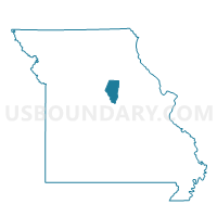
Voting District 39, Boone County, Missouri
About
Outline

Summary
| Unique Area Identifier | 607181 |
| Name | Voting District 39 |
| County | Boone County |
| State | Missouri |
| Area (square miles) | 29.08 |
| Land Area (square miles) | 28.97 |
| Water Area (square miles) | 0.11 |
| % of Land Area | 99.63 |
| % of Water Area | 0.37 |
| Latitude of the Internal Point | 39.12783730 |
| Longtitude of the Internal Point | -92.25456340 |
Maps


Graphs
Select a template below for downloading or customizing gragh for Voting District 39, Boone County, Missouri


Neighbors
Neighoring Voting District (by Name) Neighboring Voting District on the Map
- Voting District 08, Boone County, MO
- Voting District 09, Boone County, MO
- Voting District 15, Boone County, MO
- Voting District 16, Boone County, MO
- Voting District 17, Boone County, MO
Top 10 Neighboring County Subdivision (by Population) Neighboring County Subdivision on the Map
- Rocky Fork township, Boone County, MO (8,397)
- Centralia township, Boone County, MO (4,906)
- Bourbon township, Boone County, MO (2,729)
Top 10 Neighboring Place (by Population) Neighboring Place on the Map
Top 10 Neighboring Unified School District (by Population) Neighboring Unified School District on the Map
- Boone County R-IV School District, MO (7,263)
- Centralia R-VI School District, MO (7,249)
- Sturgeon R-V School District, MO (3,665)
- Harrisburg R-VIII School District, MO (3,294)